
On this page
Topographical Maps is Chapter 5 of NCERT's Class 11 book Practical Work in Geography Part I. You learn to read a toposheet's legend and contours, draw a cross-section and describe a sheet under fixed heads. This guide follows the 2026-27 CBSE syllabus and the current NCERT text (reprinted March 2026).
What does the 2026-27 CBSE syllabus include?
The CBSE Geography curriculum for 2026-27 lists study of 1:50,000 or 1:25,000 Survey of India sheets, conventional symbols and the contour cross-section. You must also identify landforms (slopes, hills, valleys, waterfalls, cliffs) and read how settlements are distributed (CBSE Geography curriculum 2026-27).
The Class 11 practical carries 30 marks: a 25-mark written exam, 3 marks for the practical file and 2 for the viva, according to the same curriculum. Topographical Maps has a weightage of 4 marks within it.
What are topographical maps and who makes them?
Topographical maps are general-purpose maps drawn at relatively large scales, showing natural and cultural features such as relief, water bodies, vegetation, farmland, settlements and transport routes; in India the Survey of India prepares them (NCERT Chapter 5). Facts that come up in short answers:
Sheets are made at 1:10,00,000, 1:250,000, 1:1,25,000, 1:50,000 and 1:25,000, covering 4° × 4°, 1° × 1°, 30' × 30', 15' × 15' and 5' × 7' 30" respectively (NCERT).
There are two series: the India and Adjacent Countries Series and the International Map Series of the World. After the Delhi Survey Conference of 1937, mapping of neighbouring countries stopped but the old numbering was kept.
Relief is shown mainly by contours and spot heights; hachures, hill shading, layer tints and benchmarks are other methods used over the years.
Conventional signs are internationally accepted, so maps read the same anywhere.
How do you read contours and landforms on a toposheet?
Contours are imaginary lines joining places of equal height above mean sea level, and the contour interval (vertical interval, VI) is usually constant on a map (NCERT). What changes is the horizontal equivalent, the gap between lines on paper. Our guide on how to read contour lines on a topographic map covers spacing and gradient. For the exam, learn each landform as a pattern:
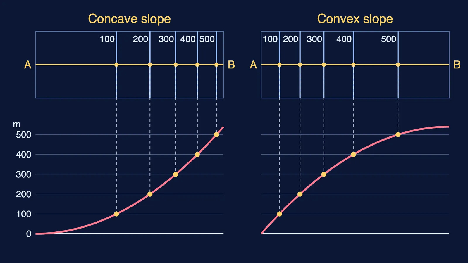
Concave slope: wide gaps low down, crowded lines near the top. Convex is the reverse.
Conical hill: concentric rings at almost regular spacing.
Plateau: lines packed at the edges, a wide gap inside the innermost one.
V-shaped valley: the innermost line has a small gap and the lowest value. A U-shaped valley has a wide gap.
Spur: V-shapes whose arms point to higher ground.
Cliff or waterfall: lines run together and merge.
The hero diagram shows the first pair: both slopes climb past 500 m, but their contours bunch at opposite ends of AB.
How do you draw a cross-section in the practical exam?
NCERT's eight steps come down to this: draw line AB across the contours, lay a paper strip along it, and mark each contour crossing with its value. Rule parallel lines for a vertical scale (NCERT's example is ½ cm = 100 metres), drop each mark to its height line, and join the points smoothly (NCERT).
A worked example. AB is 9 cm and crosses the 100, 200, 300, 400 and 500 m contours at 3.2, 4.6, 5.6, 6.5 and 7.2 cm from A. The gaps shrink from 1.4 cm to 1.0, 0.9 and 0.7 cm, so the ground steepens as you climb: a concave slope. At ½ cm = 100 m, the 500 m point sits 2.5 cm above the base. Label A and B, write the vertical scale, and draw a smooth curve.
How is a toposheet interpreted?
Orient by the north line and scale, then use NCERT's five heads (NCERT):
Marginal information: sheet number, location, grid references, extent, scale, districts.
Relief and drainage: hills, plateaus, plains, slope direction, rivers, drainage pattern.
Land use: forest, farmland, wasteland, services such as schools.
Transport and communication: roads, cart tracks, footpaths, railways, post offices.
Settlements: compact, scattered, linear or circular villages, and towns by function.
Then link the heads: villages strung along a river or road are linear. The drainage patterns you name (dendritic, radial, trellis) are covered in our Drainage System Class 11 guide.
Practice questions
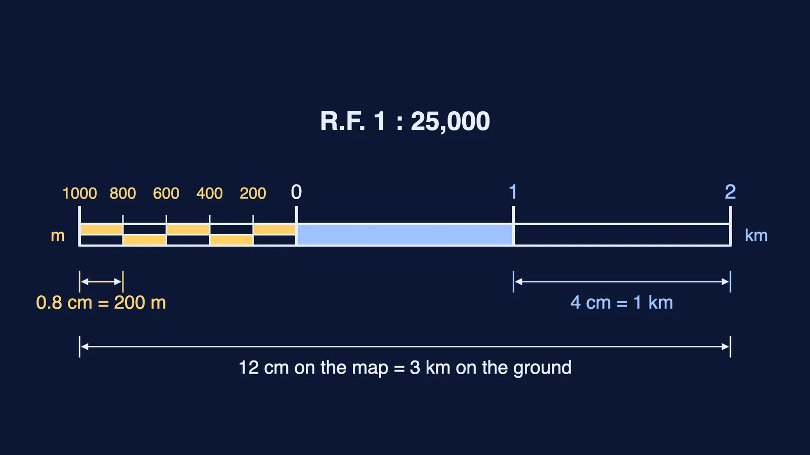
A sheet's scale is 1:25,000. What ground distance does 6 cm show? (1 mark)
Distinguish a spur from a V-shaped valley in contours. (2 marks)
Along AB, the 200, 300 and 400 m contours are 0.5 cm apart near A, the foot, and 2 cm apart near B. Name the slope type and give a reason. (2 marks)
List the five interpretation heads with one feature for each. (3 marks)
Viva: why do contours of different heights usually not cross?
If you are unsure where to start, Fermi's AI tutor works out what you already know and builds a plan for the session.