On this page
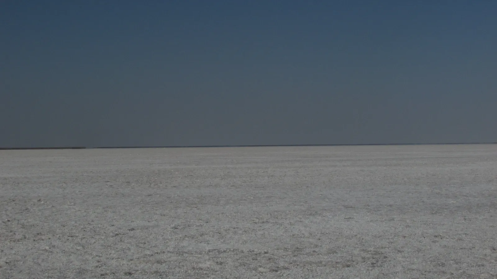
The Aral Sea, on the border of Kazakhstan and Uzbekistan, was once the fourth-largest lake in the world, according to NASA's Earth Observatory. Today most of it is desert, and the reason is a budget you can work out with Class 9 maths.
Why did the Aral Sea dry up?
In the 1960s the Soviet Union began diverting the two rivers that fed the lake, the Amu Darya and the Syr Darya, to turn the surrounding desert into farms for cotton and other crops, as NASA's Earth Observatory describes. Philip Micklin's 2007 review in the Annual Review of Earth and Planetary Sciences concludes that the drying, which started in the early 1960s, "owes overwhelmingly to the expansion of irrigation that has drained its two tributary rivers."
By the time of that review, the level had fallen 23 m, the area had shrunk 74% and the volume had fallen 90%, Micklin reports.
What is a lake's water balance?
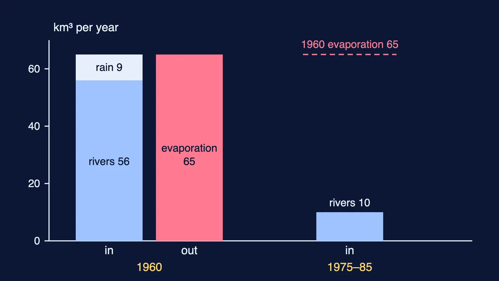
A terminal lake has no river flowing out, so water leaves only by evaporation. Its size is set by one balance: water in must equal water out.
For about 300 years before 1960, the two rivers brought in about 56 km³ of water a year and rain added about 9 km³, a total of about 65 km³ that balanced evaporation and kept the lake roughly steady at about 1,089 km³ and 67,500 km², according to Jon Conrad and Kamola Kobildjanova at Cornell University. After the diversions, average river inflow dropped to about 10 km³ a year from 1975 to 1985, the same paper reports.
How fast should the Aral Sea have shrunk?
Use the 1960 figures from Conrad and Kobildjanova.
Evaporation depth per year = 65 km³ ÷ 67,500 km² ≈ 0.00096 km, about 0.96 m a year.
New inflow = 10 km³ from rivers + 9 km³ of rain = 19 km³ a year (generous, since a shrinking lake catches less rain).
Deficit = 65 − 19 = 46 km³ a year. Over the 1960 surface, 46 ÷ 67,500 ≈ 0.00068 km: the level drops about 0.68 m in the first year.
New balance: the lake stops shrinking when its area × 0.96 m = 19 km³, so area ≈ 19 ÷ 0.00096 ≈ 19,700 km², about 29% of the 1960 area.
Micklin's 74% loss of area leaves 26%, the same ballpark, though the real lake was still shrinking. The model ignores the basin's shape and yearly swings in inflow, so treat it as a check, not a forecast.
Why did the Aral Sea get so salty?
Evaporation takes water and leaves salt behind. If the salt stays and the volume falls to a tenth, the concentration rises ten times: 10 g/l × 10 = 100 g/l. Micklin's review reports a change of that size, from 10 to more than 100 g/l (Micklin, 2007).
Micklin and Nikolay Aladin write in Scientific American that the number of fish species in the lakes fell from 32 to six, and that commercial fisheries that caught 40,000 tonnes of fish in 1960 were gone by the mid-1980s. Getting salt back out of water takes energy: see how reverse osmosis makes seawater drinkable.
If concentration and dilution still feel shaky, the Fermi Concept Library has its own lesson for every concept in chemistry, so you can close that gap before the next numerical.
Has the Aral Sea recovered?
Only the north. Kazakhstan built the Kok-Aral dike and dam, finished in 2005, which stops water flowing out of the North Aral into the lower South Aral. North Aral levels and fisheries rebounded while flow south was limited, reports NASA's Earth Observatory. The dam was an $85.8 million project backed by a World Bank loan, according to NASA.
Micklin and Aladin, in Scientific American, describe a 13 km earthen dike completed in November 2005: the water rose from 40 to 42 m in eight months, the area grew 18%, and salinity fell from about 20 to about 10 g/l. By 2008, fishers were again catching several species.
The south kept shrinking. Its eastern lobe disappeared completely in 2014, NASA reports. Restoring the whole 1960s lake would need the rivers' inflow to be quadrupled from its recent average of 13 km³ a year, Micklin and Aladin write in Scientific American.
How do you solve a stock and flow problem?
Use four steps:
Draw a box for the stock (lake, tank, bank balance, aquifer) and arrows for every input and output.
Write each flow with units and convert them to match before adding.
Find the steady state by setting inputs equal to outputs.
Check your answer against one real measurement, as we did with Micklin's area figure.
The same reasoning explains why a borewell runs dry when the water table falls and what makes the sea level rise. Budgets like these are often easier to see than to read, which is what the interactive simulations in the Fermi Simulation Lab are for.
Next time a river is diverted, ask the Aral question: what still reaches the end?