
On this page
Doppler weather radar is the technology that gives us advanced warning of severe storms, tornadoes, and flash floods. While standard radar can only tell us where it is raining, Doppler radar uses the physics of waves to reveal exactly how fast the wind is moving inside a storm.
How does Doppler weather radar track storms and rain?
The basic principle behind any radar is reflection. A radar dish, like the ones in the U.S. NEXRAD network of 160 stations, acts as both a transmitter and a receiver.
The radar emits a short burst of microwave energy—a pulse lasting just a few microseconds—and then "listens" for the echo for about a millisecond. (To understand how antennas create these pulses, read Why Accelerated Charges Produce Electromagnetic Waves.) When this energy hits an object in the atmosphere, such as a raindrop, snowflake, or hailstone, a tiny fraction of the pulse scatters and reflects back to the dish.
By timing how long the echo takes to return (t), the radar calculates the exact distance (d) to the storm using the speed of light (c) according to NOAA's Jetstream. The equation is d = (c × t) / 2, where dividing by two accounts for the round trip of the microwave pulse.
By measuring the intensity of the returning signal, the radar estimates how heavy the precipitation is. This intensity, known as reflectivity, is measured on a logarithmic scale called dBZ (decibels of Z). Because the scale is logarithmic, a small increase in the dBZ value means a massive increase in the size or number of drops. For example, a reflectivity of 50 dBZ typically indicates heavy rain and robust thunderstorms, while values above 55 dBZ strongly suggest the presence of hail, since solid ice is a highly efficient reflector of radar energy. During severe weather, the radar antenna rotates and tilts continuously, completing a full 3D volume scan of the atmosphere every 4 to 6 minutes.
How does the Doppler effect measure wind speed?
Standard radar cannot see wind. To measure velocity, meteorologists rely on the Doppler effect—the same phenomenon that makes a police siren sound higher-pitched as it approaches you and lower-pitched as it drives away.
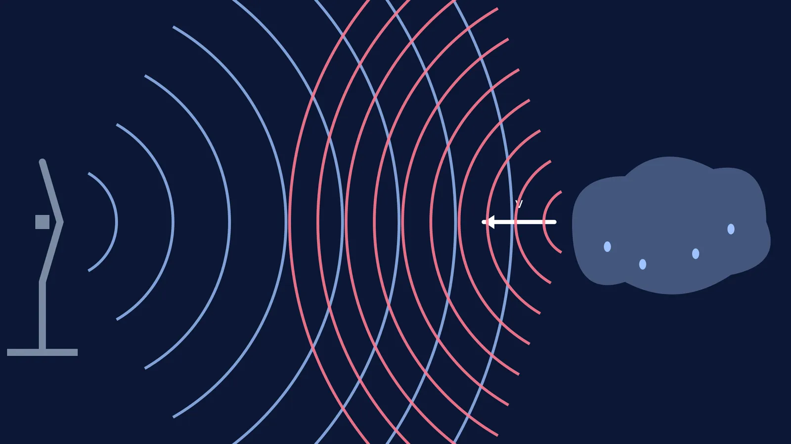
When a radar pulse hits a moving raindrop, the frequency of the reflected wave changes. If the raindrop is being blown toward the radar station, the returning waves are compressed, resulting in a higher frequency (a positive shift). If the wind is blowing the drop away from the radar, the waves are stretched, resulting in a lower frequency (a negative shift).
You can see this compression and stretching for yourself in the Doppler effect simulation: what to predict before you press play. Watching the wavefronts bunch up in the direction of motion makes the physics instantly clear.
How does the radar equation calculate radial velocity?
The radar's computer uses the frequency shift to calculate the storm's "radial velocity" (the speed moving directly along the radar's line of sight). The formula used by systems like the WSR-88D is:
f_d = (2 × v_r) / λ
Here, f_d is the Doppler frequency shift (in Hertz), v_r is the radial velocity (in metres per second), and λ is the wavelength of the radar's transmitted wave.
The factor of 2 is crucial: it accounts for the "double Doppler shift." The wave's frequency is shifted once when it strikes the moving raindrop, and shifted a second time as the raindrop re-emits the echo back to the stationary radar dish.
If we rearrange the formula to find the speed of the storm, we get:
v_r = (f_d × λ) / 2
For example, a NEXRAD S-band weather radar operates at a wavelength of 10 cm (0.1 metres). If the radar measures a frequency shift of 200 Hz, the storm's velocity is:
v_r = (200 × 0.1) / 2 = 10 metres per second.
If you struggle to picture how changing one variable affects another, you can run experiments in the Fermi Simulation Lab. Seeing the mathematical relationship play out interactively can deepen your understanding before an exam.
Why does Dual-Polarization matter?
Modern Doppler radars do more than measure speed; they also identify the shape of the falling objects using Dual-Polarization.
Traditional radars send out a single horizontal wave, which only measures the width of an object. Dual-Polarization radar, on the other hand, sends out both horizontal and vertical pulses simultaneously.
Raindrops flatten out like hamburger buns as they fall due to air resistance. They return a stronger horizontal signal.
Hailstones tumble as they fall, making them appear roughly spherical to the radar. They return equal horizontal and vertical signals.
By comparing the two returns, meteorologists can confidently distinguish between a heavy rainstorm and a dangerous hailstorm, or even detect flying debris lofted by a tornado, long before it can be seen from the ground.