On this page
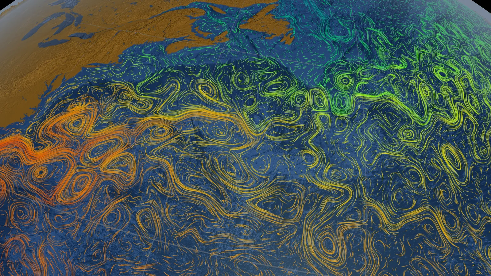
Every big loop of ocean current, or gyre, is lopsided. Each is "flanked by a strong and narrow 'western boundary current,' and a weak and broad 'eastern boundary current,'" says NOAA's ocean currents tutorial. The Gulf Stream, off North America's east coast, is the famous example. In 1948 Henry Stommel explained why with a simple model.
Why is the Gulf Stream on the west side of the Atlantic?
The Gulf Stream is fast: its average speed is 6.4 km/h, with a maximum of about 9 km/h near the surface, according to NOAA's National Ocean Service. It carries about 30 million cubic metres of water per second through the Florida Straits (Gulf Stream, Wikipedia).
Winds alone don't explain this. Trade winds blowing west in the tropics and westerlies blowing east at mid-latitudes twist the subtropical Atlantic clockwise. So why does the fast return flow pile up against one coast?
What did Henry Stommel show in 1948?
Stommel was born in Wilmington, Delaware, in 1920, studied astronomy at Yale and joined the Woods Hole Oceanographic Institution in 1944, according to Carl Wunsch's National Academy of Sciences memoir. Wunsch calls him "probably the last of the creative physical oceanographers with no advanced degree".
His paper, "The westward intensification of wind-driven ocean currents", appeared in Transactions of the American Geophysical Union in April 1948. It modelled a homogeneous, rectangular ocean with wind at the surface, friction at the bottom, pressure differences from a sloping sea surface, and the Coriolis force. The streamlines crowded intensely along the western border, and Stommel traced this to the Coriolis parameter changing with latitude.
Wunsch writes that the paper showed "the Gulf Stream was a phenomenon that could be explained deductively by fluid dynamics", and that many scientists "must have kicked themselves for not having seen the problem and its mathematically easy solution." A year earlier, Harald Sverdrup had published his own theory of wind-driven currents, which our post on Sverdrup's ocean unit introduces. Walter Munk extended Stommel's theory in 1950007%3C0080:OTWDOC%3E2.0.CO;2).
How does a changing Coriolis effect push currents west?
The Coriolis frequency is f = 2Ω sin φ, where Ω = 7.2921 × 10⁻⁵ rad/s is Earth's rotation rate and φ is latitude (Coriolis frequency). Think of f as the spin a water column gets from the planet under it; its rate of change northwards is called β. For where the effect comes from, see our post on Gustave Coriolis and the Coriolis effect.
Here is the spin budget in Stommel's model:
The wind twists the whole basin clockwise.
In the wide interior, water drifts slowly towards the equator. Moving to where f is smaller works like taking on clockwise spin, so it balances the wind.
The water must return north somewhere. Going north, f grows, so the column needs a source of anticlockwise spin. The wind cannot supply it.
Friction can, but only if the current itself spins clockwise. In Stommel's model a northward jet against the western wall is fastest at the coast and slower offshore, so it does. Friction damps that clockwise spin, which is the anticlockwise push the budget needs.
Against the eastern wall the same jet's shear spins the other way, and friction pushes the wrong way. So the return flow squeezes into a narrow, fast western current.
Worked example: how much does f change across the gyre?
Use f = 2Ω sin φ with Ω = 7.2921 × 10⁻⁵ rad/s (Coriolis frequency).
At 20°N: f = 2 × 7.2921 × 10⁻⁵ × 0.342 ≈ 5.0 × 10⁻⁵ rad/s.
At 40°N: f = 2 × 7.2921 × 10⁻⁵ × 0.643 ≈ 9.4 × 10⁻⁵ rad/s.
Ratio: 9.4 / 5.0 ≈ 1.9, so the planet's spin almost doubles between 20°N and 40°N, roughly the span of the subtropical gyre.
Now make f the same everywhere. Step 2 stops working, neither wall is favoured and the gyre comes out symmetric. Rotation alone is not enough; it has to change with latitude.
How do you explain westward intensification in an exam or viva?
The Kuroshio off Japan and the Agulhas off South Africa are western boundary currents too, while eastern boundary currents are shallow, broad and slow (boundary currents). For an olympiad interview or project viva, use four sentences:
"Winds twist the subtropical ocean clockwise in the northern hemisphere."
"Because the Coriolis parameter grows with latitude, the interior water drifts slowly towards the equator to balance that twist."
"The return flow must go north, and only on the western side can friction balance the spin it gains."
"So western currents like the Gulf Stream are narrow and fast, and eastern ones broad and slow, as Stommel showed in 1948."
If the Coriolis force itself is the shaky part, the Fermi Concept Library gives each concept its own lesson and its place in the map. If you learn better by watching things move, the Fermi Simulation Lab has interactive simulations for ideas that are easier to see than to read.
For how the current was first mapped, read Benjamin Franklin's Gulf Stream chart.