On this page
Vijayanagara is a Class 12 History chapter you can walk through in your head: a river, rings of walls, a royal quarter and a temple quarter. Learn that layout first, and many exam questions become placing things on the map and explaining why.
What does the Class 12 syllabus ask about Vijayanagara?
In the CBSE History curriculum for 2026-27, An Imperial Capital: Vijayanagara (c. fourteenth to sixteenth centuries) is Theme 7, in Themes in Indian History Part II.
Part II carries 25 of the 80 theory marks. Each part is tested through 7 one-mark MCQs, 2 three-mark short answers, 1 eight-mark long answer and 1 four-mark source-based question, according to the same document.
The theme's learning outcomes ask you to classify Vijayanagara's architecture, to analyse foreign travellers' accounts of the city, and to assess its city planning, water management and administration. Vijayanagar is also on the Part II map list, beside Bidar, Golconda and Bijapur.
How was Vijayanagara laid out?
The name Vijayanagara means City of Victory, and the city was founded by Harihara I and Bukka, the Sangama brothers, according to Wikipedia's Vijayanagara article. By the early sixteenth century it had grown into a metropolis of about 650 square kilometres, the same article says. Two visitors whose accounts it quotes are Abdur Razzaq from Central Asia and Domingo Paes, a Portuguese who came in 1522.
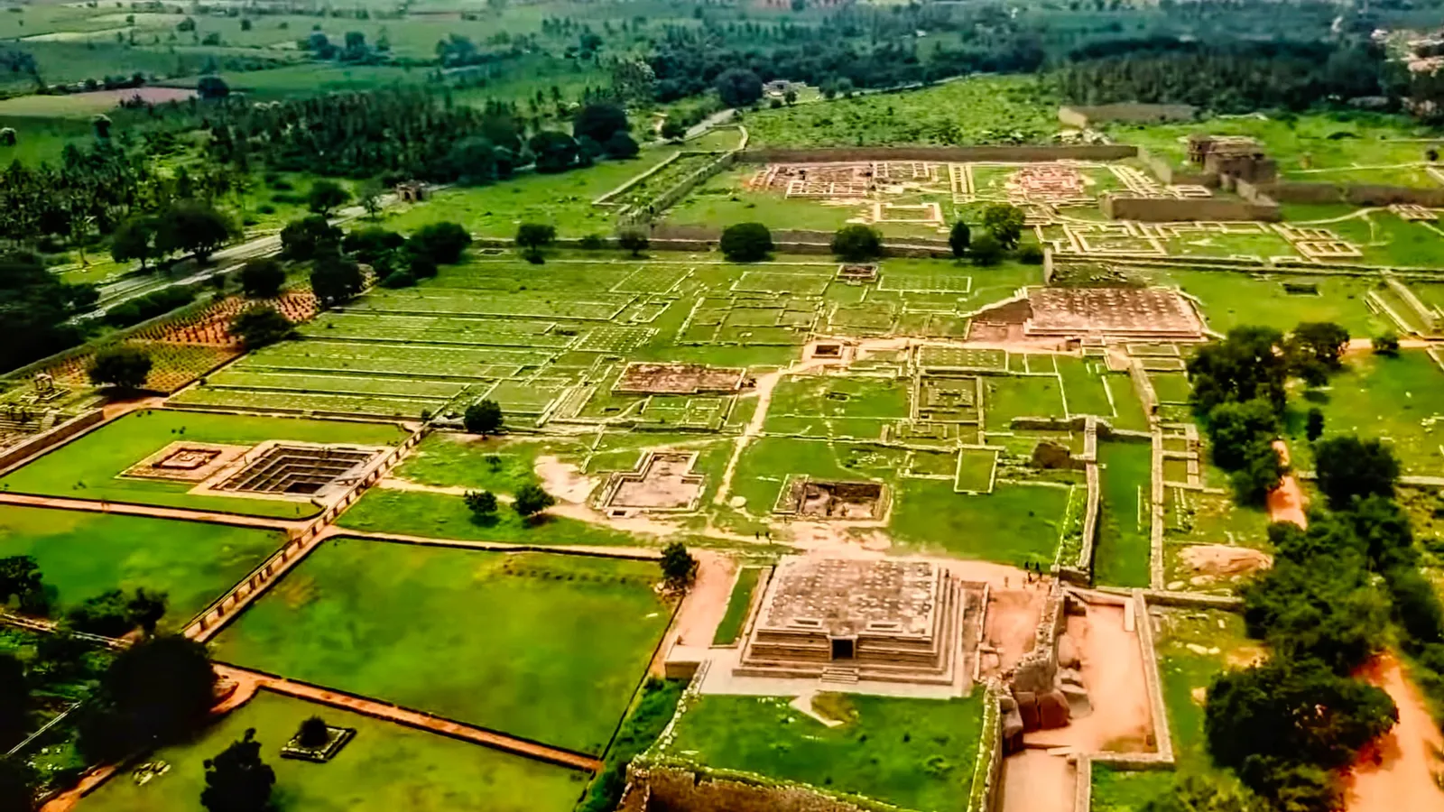
Hampi was the capital from 1336 to 1565. That year a coalition of sultanates defeated the empire at the Battle of Talikota, and the city was sacked and later abandoned, as Wikipedia's Hampi article records. UNESCO inscribed the Group of Monuments at Hampi in 1986, and the site has more than 1,600 surviving remains (same article).
Picture three zones:
The sacred centre, by the Tungabhadra, with the oldest temples and attached markets.
The urban core, which includes the royal centre.
A farmed valley between the two, watered by canals and kept inside the fortifications.
The farmed valley, and the reasoning behind it, are set out in these NCERT Chapter 7 solutions from eVidyarthi. Medieval sieges tried to starve defenders into surrender, so protecting the fields kept food and land revenue safe. The cost was high: expensive fortifications and a large army to guard them.
How did Vijayanagara get its water?
The city drew on a natural basin formed by the Tungabhadra, which flows north-east among granite hills, according to the eVidyarthi NCERT solutions. Because the region is dry, the rulers built embankments and reservoirs to hold rainwater. Learn three works by name:
Kamalapuram tank, built in the fifteenth century. Its water irrigated nearby fields and supplied the royal centre.
Hiriya canal, which drew water from a dam across the Tungabhadra and was used for irrigation.
Embankments and reservoirs of different sizes for storing rainwater.
What happened in the royal centre and the sacred centre?
Whether the royal centre deserves its name is a textbook question. It held over 60 temples, but only thirty building complexes have been identified as palaces, according to the eVidyarthi NCERT solutions.
The mahanavami dibba is a large platform linked to the Mahanavami (Navaratri) festival, held for nine days in September and October, the same solutions say. Rites included worship of the state horse, dances, wrestling and processions. On the last day the king inspected his army and received gifts from the nayakas. That is why historians read the festival as a show of royal power.
The Lotus Mahal was named by British travellers in the nineteenth century; one view is that it was a council chamber (same source).
The sacred centre, beside the river, holds Hampi's oldest temples, and the Virupaksha temple is its oldest shrine, according to Wikipedia's Hampi article. Colin Mackenzie, the East India Company engineer who brought the ruins to light in 1800, first based his information on the memories of the temple's priests, the eVidyarthi solutions note. For the physics hidden in Hampi's carved stone, read our piece on the musical pillars of Hampi and the science of sound. If waves are easier to see than read, try the Fermi Simulation Lab.
How should you revise this chapter in a week?
Day 1: draw the three zones from memory, then check against the textbook map.
Day 2: water works, with one line on why each was needed.
Day 3: royal centre and the mahanavami dibba, written as a festival sequence.
Day 4: sacred centre and the travellers' accounts.
Day 5: one source-based question under time; our guide to case-based questions in board exams shows how to read the source first.
Day 6: an 8-mark answer, using the frame below.
Day 7: a cause-and-effect chart from founding in 1336 to abandonment after 1565.
Start with Day 1 tonight: a blank page, three zones and the river.