

On this page
India is home to two of the world's most famous tea-growing regions: the high hills of Darjeeling and the floodplains of Assam. While their final cups taste completely different—Darjeeling offers delicate, floral notes, while Assam brews a bold, malty black tea—both rely on a precise balance of heavy rainfall, temperature, and rapid drainage.
Why do tea plants need so much rain?
Tea is a thirsty plant that relies on heavy, consistent precipitation to produce a continuous flush of fresh leaves. In North East India, the average annual rainfall for a tea estate is between 2000 mm and 4000 mm (Tocklai Tea Research Association). This water must be well-distributed throughout the year. A prolonged dry spell from November to March can halt leaf production entirely and severely damage the bushes. The high humidity of these regions keeps the plants from losing too much moisture to the air.
Temperature also plays a major role in the growing cycle. Darjeeling's high elevation brings low temperatures and heavy mist, which forces the tea bushes to grow slowly. This slow growth is what concentrates the complex chemical compounds responsible for the tea's famous "Muscatel" flavour and floral aroma (Tea Board of India). In contrast, Assam experiences high heat and extreme humidity, creating a tropical greenhouse effect that leads to rapid growth and a brisk, strong brew.
Why is tea grown on hill slopes?
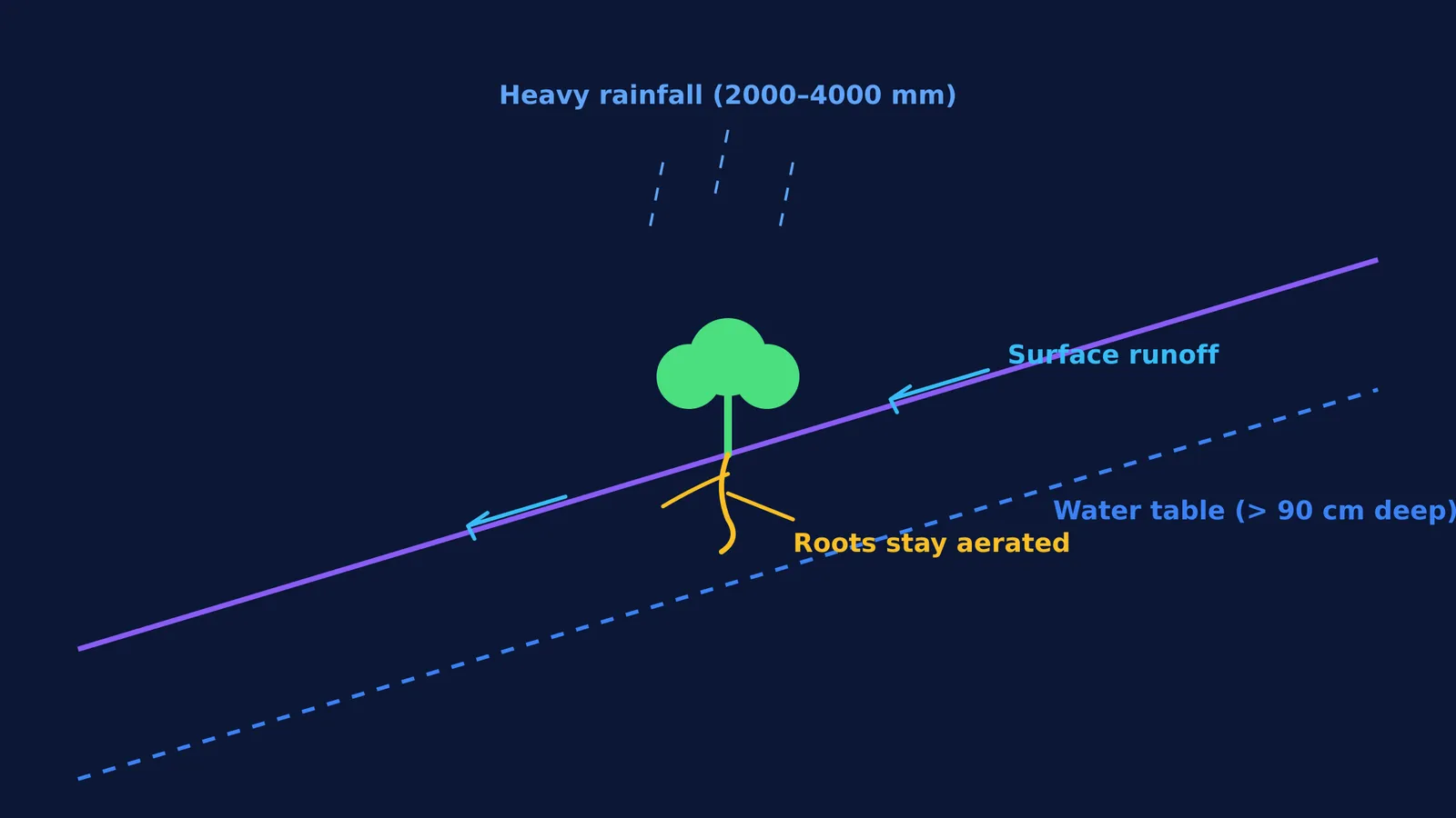
The single most important geographical rule for a tea estate is that water must not stand still. While tea bushes need plenty of rain, their roots are highly sensitive to waterlogging. The groundwater table must remain at least 90 cm below the surface for the roots to breathe and grow healthily (Tocklai Tea Research Association). If water stagnates, the roots are deprived of oxygen and begin to rot.
In Darjeeling, the natural topography solves this problem. Darjeeling tea is grown at elevations ranging from 600 to 2,000 metres above sea level (Tea Board of India). The steep mountain gradients ensure that even the heaviest monsoon downpours drain away immediately. The roots grow deep, responding to gravity—a process you might recall from our guide to phototropism, geotropism and other tropic movements in Class 10. The combination of slope and high altitude means the soil rarely remains saturated.
In the low-lying Brahmaputra valley of Assam, the plants sit close to sea level on flat floodplains. Because the land has very little natural slope, these estates must carefully manage the terrain. They dig extensive networks of artificial leader and lateral drains to carry water away and keep the water table safely below the root zone.
What is the chemistry of tea soil?
Beyond drainage, tea plants are remarkably picky about their soil chemistry. They are acidophilic, meaning they only thrive in acidic soils. The ideal soil pH for a tea garden lies between 4.5 and 5.5 (Tocklai Tea Research Association). In soils that are too alkaline, the plant cannot absorb essential nutrients like iron and manganese, leading to stunted growth. Estates regularly test their soil and apply agricultural lime if the pH drifts too low. (To review how pH indicators work, see our notes on acids, bases and salts in Class 10: indicators, pH and common salts).
Furthermore, the soil must be deep and rich in decaying plant material. A healthy tea soil contains more than 2% organic matter, which helps the ground hold onto just enough moisture to survive the dry months without waterlogging the roots (Tocklai Tea Research Association). The soil also needs to be free of hard, compacted layers up to a depth of 2 metres, allowing the taproots to anchor the plant securely (Tocklai Tea Research Association). You can explore the layers and components of topsoil in our piece on Nature's treasures in Class 6 Curiosity: air, water, forests, soil.
If you are trying to picture how water percolates through different soil types or how a root system behaves on a gradient, the Fermi Simulation Lab offers interactive simulations for ideas that are easier to see than to read. Setting up a visual model can make these geographical concepts immediately clear rather than just a list of facts to memorise.


