On this page
Studying glaciers is not just about scaling peaks; it is about treating a river of ice as a large physics problem. Glaciologists track how ice deforms under its own weight, how water flows beneath it, and how it responds to a warming atmosphere. As the primary source of water for major river systems, the health of these glaciers directly impacts the water supply for millions of people downstream.
According to a satellite inventory by the Indian Space Research Organisation (ISRO), there are thousands of glaciers across the Himalayan, Trans-Himalayan, and Karakoram regions. Monitoring these freshwater reserves requires researchers who can combine mathematical modelling with rigorous fieldwork, often working in some of the most remote and challenging environments on the planet.
What does a glaciologist actually do?
The day-to-day work of a glaciologist is split between analysing satellite data, writing code, and conducting field expeditions.
In the field, scientists hike to glaciers to install instruments, measure ice melt (ablation), and drill ice cores. This work happens at high elevations. For instance, the National Centre for Polar and Ocean Research (NCPOR) operates the HIMANSH research station in Himachal Pradesh at an altitude of 4,080 meters. At these heights, researchers camp for weeks in sub-zero temperatures to monitor weather stations and measure ice thickness using ground-penetrating radar.
Back in the lab, glaciologists write scripts to analyse radar data and build climate models. The ground-penetrating radar data collected in the field provides a cross-sectional profile of the glacier, revealing the bedrock topography underneath the ice. By mapping the bedrock, scientists can calculate the total volume of ice and estimate how much freshwater is stored. If you have read about Milutin Milankovic and the orbital cycles behind ice ages, you will know that long-term climate shifts govern glacier health by altering the solar radiation reaching the Earth. Today's glaciologists simulate these shifts using modern computing, predicting how fast a glacier will retreat over the next century. These models require a firm grasp of fluid dynamics, heat transfer, and numerical methods to forecast changes accurately.
What physics and maths do you need?
Glaciology is deeply rooted in mechanics and thermodynamics. Ice is not a rigid solid; under immense pressure, it behaves like a highly viscous fluid, which is why glaciers flow downhill like very slow rivers. The deformation of ice is non-linear and heavily dependent on temperature and the structure of the ice crystals.
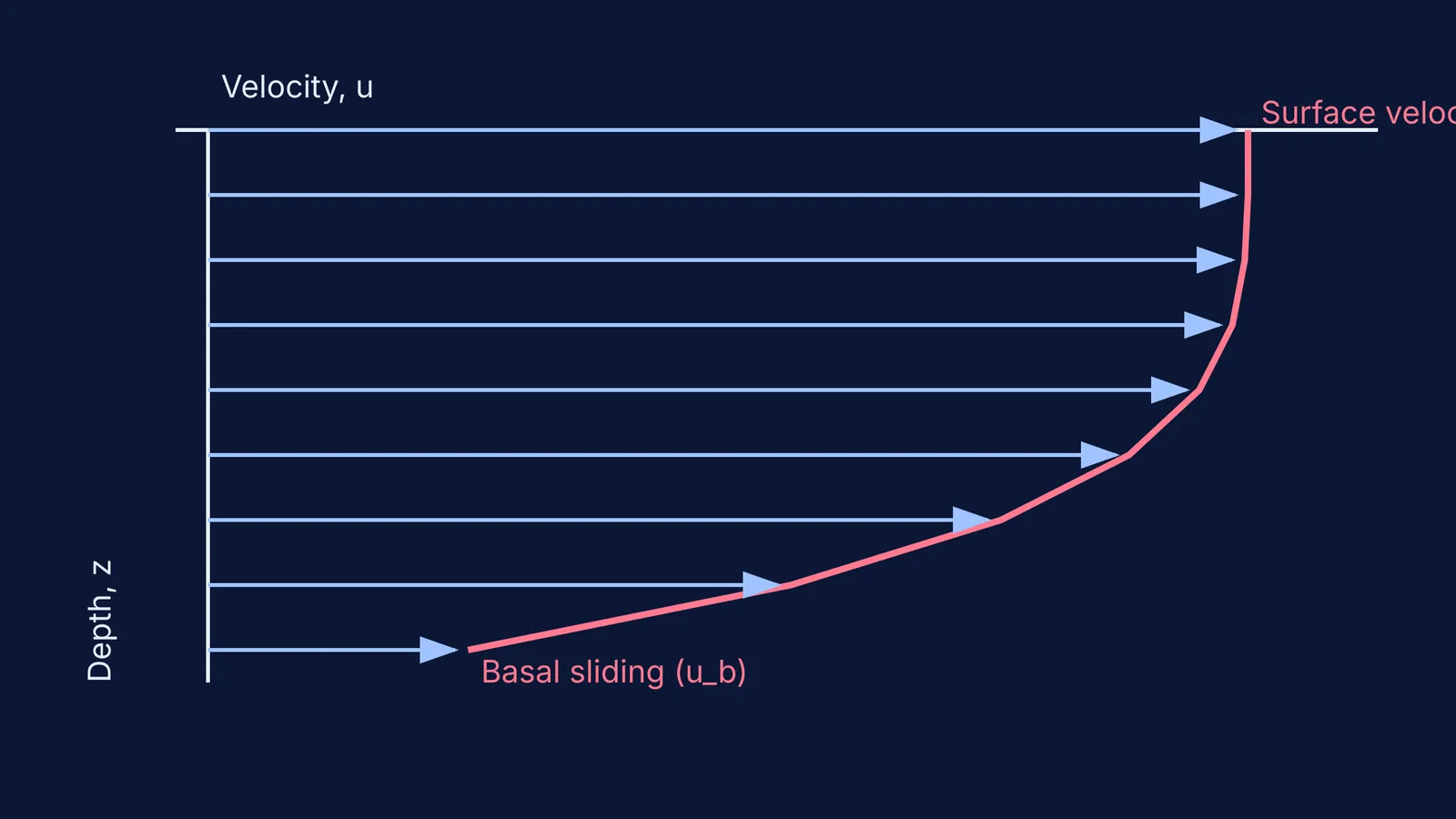
To understand how a glacier flows downhill, you must master Glen's Flow Law, an empirical equation that links the strain rate of ice to the shear stress applied by gravity. Unlike a Newtonian fluid where the flow rate is directly proportional to stress, the strain rate of glacier ice is proportional to the shear stress raised to a power (usually around three). This means that a small increase in the steepness of the terrain or the thickness of the ice leads to a much larger increase in how fast the ice deforms. Calculating the velocity of ice at different depths requires setting up and solving integrals of these stress functions from the glacier bed to the surface. If you are practising how to integrate acceleration given as a function of velocity or position, you are building the exact mathematical tools needed to model glacier flow. Understanding the basal sliding—how the glacier slips over the bedrock due to a thin layer of meltwater—adds another layer of complexity to the boundary conditions of these differential equations.
If you get stuck trying to visualise these variable mass systems or complex integrals during your degree, the Fermi Problem Library has worked problems with a step-by-step solver that explains the reasoning. For abstract concepts like phase changes and thermodynamics, the Fermi Concept Library can help you close your concept gaps.
How to become a glaciologist in India?
Building a career studying Himalayan glaciers follows a structured academic path:
High School: Choose the science stream with Physics, Chemistry, and Mathematics (PCM).
Undergraduate Degree: Pursue a B.Sc. or B.Tech in Geology, Earth Sciences, Physics, or Civil Engineering. A strong physics background is especially helpful for understanding ice dynamics and thermodynamics.
Postgraduate Degree: Complete an M.Sc. or M.Tech in Applied Geology, Geophysics, Remote Sensing, or Climate Science.
National Exams: Clear the CSIR-UGC NET or GATE. This qualifies you for a PhD program and research funding from government bodies.
Doctorate (PhD): A PhD is required to become a lead scientist. As a Junior Research Fellow (JRF), you will receive a monthly stipend for the first two years, plus house rent allowance (HRA) and a contingency grant to support your research and fieldwork.
After your PhD, you can work as a scientist at government institutes like the Wadia Institute of Himalayan Geology (WIHG), the Geological Survey of India (GSI), or in academia as a university professor.