On this page
Why does spatial thinking matter?
Map work is often seen as a memory test, but it is actually a workout for spatial thinking—the ability to visualise, interpret and reason about space. A meta-analysis of 217 studies by Uttal et al. (2013) found that spatial thinking is not a fixed trait; it can be improved significantly through training. The researchers found an average effect size of 0.47 across these studies, which means targeted practice yields a moderate but highly reliable boost in spatial ability.
More importantly, the same researchers found that strong spatial skills are a powerful predictor of later success in STEM fields (science, technology, engineering and mathematics). When your child practises reading a map, they are building the same mental machinery they will later use to rotate molecules in chemistry or picture forces in physics. Visualising how a mountain range shapes a river basin uses similar cognitive resources to imagining the structure of a cell. (To understand how the brain handles these mental images, see our guide to Alan Baddeley's working memory model).
How do outline maps help?
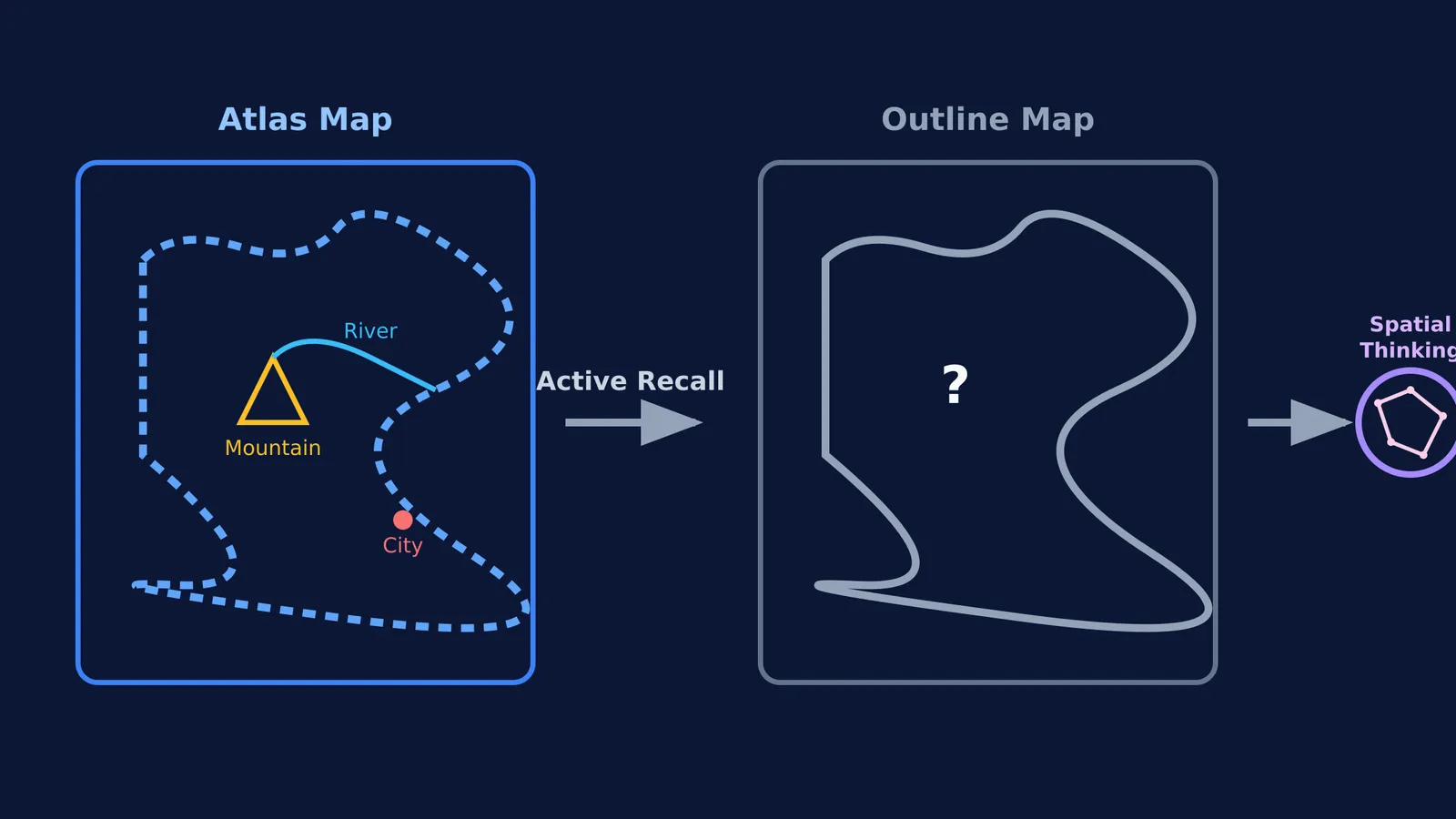
An outline map—a blank map showing only borders—is a powerful tool for active learning. Rather than passively staring at a completed atlas, a student must actively recall where things belong. This process forces the brain to retrieve information from memory, which strengthens the neural pathways associated with that knowledge. A 2019 survey of geography teachers by Hanus and Havelková found that 92% categorised working with outline maps as a form of map-making, showing how common the practice is in schools. However, to get the most out of it, the practice must be active rather than just copying from one page to another.
To use this at home, give your child a blank map and an atlas. Ask them to study a specific region in the atlas for a few minutes, close the book, and then draw and label as many features as they can remember. Checking their own work against the atlas afterwards reinforces the memory far better than reading alone. When they find a mistake, the immediate feedback helps them correct their internal mental map. This practice-testing method is one of the highest-rated study techniques according to cognitive scientists, because it moves students away from the illusion of competence that comes from just re-reading a textbook.
How can we connect maps to the real world?
Geography sticks best when it connects to the real world. You can move map work beyond school assignments by linking it to news, current events and travel. If there is a cyclone in the Bay of Bengal, a volcanic eruption in Iceland, or a sports tournament in Australia, open the atlas together to find the location. Tracing the path of the storm or locating the host city adds a layer of meaning to the exercise.
This habit gives abstract geography facts a concrete anchor. It also teaches your child that an atlas is a tool for understanding the world, not just a textbook for passing exams. When they see geography as a way to make sense of the news they hear every day, their intrinsic motivation to learn increases.
How can you build a strong study habit?
A regular, low-stress routine is the best way to help your child master map work. Focus on one theme at a time: label only the major rivers in a single session, and the mountain ranges the next. This prevents them from feeling overwhelmed by a cluttered map. Breaking the learning down into small, manageable chunks—often called spaced practice—ensures that the material is actually retained over the long term.
If your child is working on a complex school topic—like interpreting climate data or understanding river systems—and they do not know where to start, Fermi's AI tutor can work out what they already know and build a plan for the session. Rather than just giving the answer, it teaches through the topic, checking understanding as it goes. For related concepts in earth science or physics that are hard to picture on paper, the Fermi Simulation Lab provides interactive simulations to make the ideas clear. Exploring how tectonic plates move or how ocean currents circulate in a simulation can bring the static lines of an atlas to life.