On this page
In the early eighth century, the Chinese calendar was drifting out of sync with the sky. For a Tang Dynasty emperor, predicting celestial events like solar eclipses accurately was a matter of state security, as the calendar demonstrated the ruler's divine mandate. To fix the discrepancies, Emperor Xuanzong commissioned a Buddhist monk and brilliant astronomer named Yi Xing (683–727 AD) to gather fresh data. Yi Xing knew that ancient rules of thumb were not enough; he needed real measurements from across the empire.
What was the meridian survey?
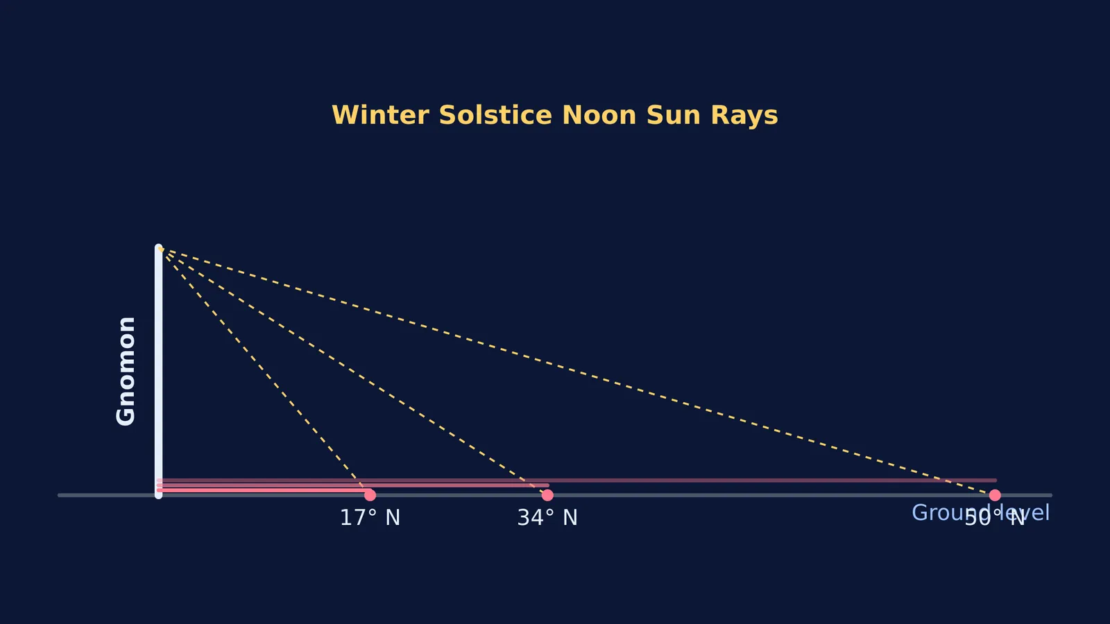
In the early eighth century, Yi Xing led a massive astrogeodetic survey. He established 13 test sites across the Tang Empire, stretching from Jiaozhou in modern-day Vietnam (17° N) to the region south of Lake Baikal (50° N) 1.
At each site, surveyors used a gnomon (a vertical rod) to measure the length of the sun's shadow at solar noon on the summer and winter solstices. They also carefully measured the altitude of the North Star (Polaris) to understand their exact position relative to the celestial pole.
Before this survey, Chinese astronomers relied on linear rules of thumb which stated that the length of a noon shadow changed by a constant amount for every set distance travelled north or south. Yi Xing's synchronised data proved this ancient rule wrong, showing that the relationship between distance and shadow length was non-linear and depended on the latitude of the observer.
By comparing the ground distance between sites with the changing angle of the North Star, Yi Xing calculated the length of a meridian arc. Although he operated under the traditional Chinese cosmological view of a canopy heaven rather than a spherical Earth, his survey was one of the most accurate early measurements of the Earth's surface, marking a turning point in the history of geodesy.
How do you calculate latitude from a shadow?
The survey relied on basic trigonometry. At winter solstice, the sun is 23.5° south of the equator 1. The gnomon and its shadow form a right-angled triangle. By measuring the shadow, Yi Xing's team could find the sun's angle using the tangent ratio (where the tangent of the angle is the gnomon's height divided by the shadow's length).
Once you know the sun's angle at noon, you can easily find the latitude by subtracting the sun's declination. Physics and maths problems often hide simple triangles inside complex scenarios like this. If you are struggling to connect angles, vectors or forces, the Fermi Problem Library has worked problems with a step-by-step solver that explains the reasoning rather than printing an answer.
What was the water-driven armillary sphere?
Yi Xing's genius was not limited to surveying. In 725 AD, he partnered with the mechanical engineer Liang Lingzan to build the "Water-Driven Spherical Bird's-Eye-View Map of the Heavens" 1.
This was a magnificent bronze and iron celestial globe powered by the steady flow of water. Crucially, it featured the world's earliest known mechanical escapement. Instead of continuous, unregulated flow, the escapement controlled the water to make the clock move in discrete, timed intervals. Two wooden jacks stood on the horizon of the device; one automatically struck a bell every hour, and the other beat a drum every quarter-hour, serving as a highly accurate public clock.
The sphere made one complete revolution every 24 hours, matching the diurnal motion of the stars. It also had rings to track the sun (moving 1 degree eastwards per day) and the moon (moving 13 and 7/19 degrees eastwards per day) 1. Visualising how the sun and moon move across a rotating sky is tricky. The Fermi Simulation Lab provides interactive simulations for the ideas that are easier to see than to read, letting you explore geometry in three dimensions.
Read more about the history of geodesy and timekeeping in our posts on Gladys West and the precise Earth model that GPS relies on, and Su Song and the water-driven astronomical clock tower.