

On this page
When a severe cyclone makes landfall, the most violent winds and torrential rain are found in the eyewall. But if you stand in the very centre of the storm, the winds drop, the rain stops, and you might even see blue sky.
This dramatic change is driven by two physical processes: the balance of forces that keeps the storm spinning, and the thermodynamics of sinking air.
Why is the eye of a cyclone calm and clear?
The eye is a roughly circular area, typically 30 to 65 kilometres across, at the centre of a severe tropical cyclone. It contains the lowest surface pressure of the entire system.
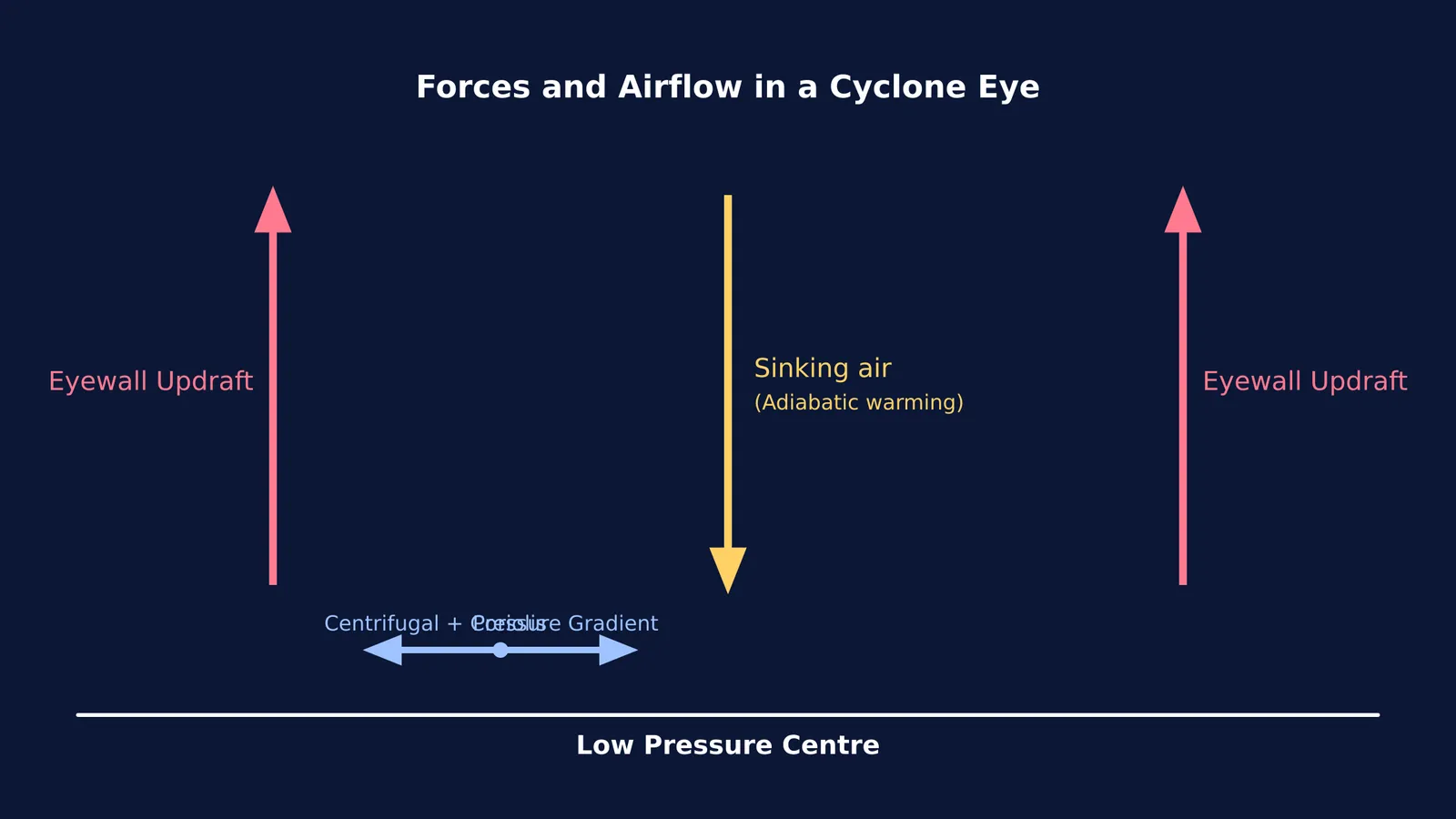
Despite this low pressure, the eye remains clear because air from the upper atmosphere slowly sinks into it. As this air descends, it compresses and warms, a process that evaporates any existing clouds. The winds remain calm because the inward pull of the low pressure is perfectly balanced by the outward fling of the spinning storm, creating an invisible barrier that the winds cannot cross.
How does adiabatic warming clear the clouds?
In the eyewall, warm, moist air rises rapidly, cools, and condenses into towering thunderstorms. But at the top of the storm, a small fraction of this air is forced inward and begins to sink down the centre.
As this air descends from the thin upper atmosphere toward the surface, it moves into an area of higher pressure. This pressure compresses the sinking air. According to the laws of thermodynamics, when a gas is compressed quickly without losing heat to its surroundings, its temperature rises. This is known as compressional or adiabatic warming. (You can compare this to the opposite effect when a gas cools during the free expansion of an ideal gas).
This warming effect is extreme at high altitudes. According to the US National Oceanic and Atmospheric Administration (NOAA), the eye can be 10 °C warmer than the surrounding storm at an altitude of 12 kilometres.
Because warm air can hold more water vapour than cold air, this sudden heating lowers the relative humidity. Any cloud droplets quickly evaporate, leaving the eye completely clear. (For more on how gases respond to pressure and temperature changes, see our guide to heat in isobaric and isochoric processes).
Why can't the winds reach the centre?
Wind is driven by the pressure gradient force: air naturally flows from high pressure to low pressure. Since the eye has the lowest pressure, you might expect the strongest winds to blow straight into the centre.
Instead, the air is deflected by the Coriolis force, causing it to spiral inward. As the air gets closer to the centre, conservation of angular momentum forces it to spin faster and faster.
This intense rotation creates a strong outward centrifugal force. At the eyewall, this outward push becomes exactly equal to the inward pull of the pressure gradient. This state is called gradient wind balance. Because the forces are tied, the racing air cannot move any closer to the centre. Instead, it is forced violently upward.
This balance creates a "hole" in the middle of the storm where the horizontal pressure gradient is very weak, leaving the air inside relatively stagnant and calm.
Seeing the forces in balance
Understanding the eye of a cyclone requires bringing together thermodynamics, circular motion, and fluid dynamics. It is a classic example of how opposing physical forces can create a pocket of stillness in the middle of chaos.
If you find it hard to picture how these forces balance in a spinning vortex, the Fermi Simulation Lab has interactive simulations for the ideas that are easier to see than to read.


