

On this page
In short
NavIC is India's regional satellite navigation system, using seven satellites to provide a position accuracy of better than 20 metres across the country and up to 1,500 km beyond its borders. While the American GPS relies on moving satellites in medium Earth orbit, NavIC uses geostationary and geosynchronous orbits to remain fixed over the Indian subcontinent.
When you open a maps app on a new smartphone in India, you are no longer relying solely on the American Global Positioning System (GPS). Your phone is likely also listening to NavIC, the Navigation with Indian Constellation.
Built by the Indian Space Research Organisation (ISRO), NavIC was developed to give India an independent, highly accurate navigation system. But NavIC is not just a clone of GPS. Because it was designed to serve one specific region of the globe rather than the entire planet, it works differently.
How are the orbits different?
The most fundamental difference between GPS and NavIC is where their satellites fly.
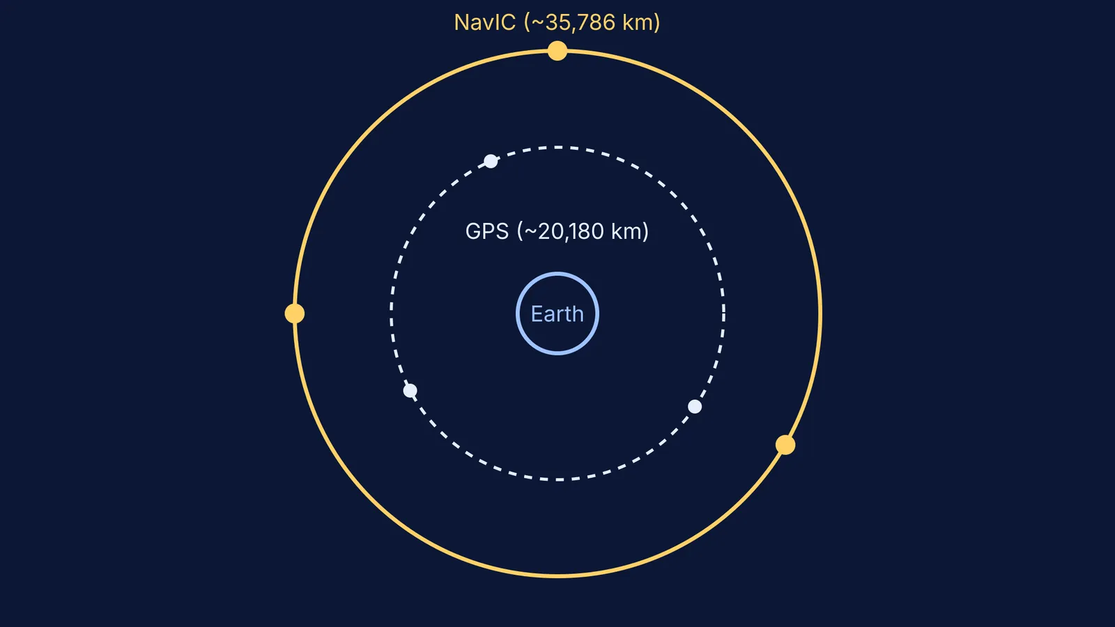
GPS is a global system. It operates a constellation of 31 operational satellites in Medium Earth Orbit (MEO), at an altitude of approximately 20,180 km. Because they are relatively close to Earth, these satellites move rapidly across the sky, completing an orbit roughly every 12 hours. At any given moment, you can only see a few of them from the ground, while the rest are serving other parts of the world.
NavIC is a regional system, designed primarily for India and the area extending 1,500 km beyond its borders. To keep its satellites constantly visible over this area, ISRO placed them much higher in space. The seven NavIC satellites fly at an altitude of approximately 35,786 km.
At this height, their orbital period matches Earth's rotation. Three of them are in Geostationary Orbit (GEO), meaning they sit directly over the equator and appear completely stationary in the sky. The other four are in Inclined Geosynchronous Orbit (GSO), tracing a tight figure-eight pattern over the Indian longitude each day. Visualising how satellites behave at 20,180 km versus 35,786 km is easier when you can watch them move; you can set up both orbital mechanics in the Fermi Simulation Lab to see why geostationary satellites appear to hover in one spot.
Because NavIC satellites are parked directly overhead rather than near the horizon, their signals are less likely to be blocked by tall buildings or mountains in India. This geometry gives NavIC excellent vertical accuracy for users in the subcontinent.
Why does dual-frequency matter?
The second major difference is how the systems handle the ionosphere, a layer of charged particles in the upper atmosphere. When navigation signals pass through the ionosphere, they slow down. This delay is the largest source of error in satellite navigation.
Standard civilian GPS receivers rely mostly on a single frequency (the L1 band). To correct for the ionospheric delay, they use a mathematical average called the Klobuchar model. However, the ionosphere is highly variable over the equator and the Indian subcontinent, making global averages less accurate.
NavIC solves this by transmitting on two frequencies simultaneously: the L5 band (1176.45 MHz) and the S-band (2492.028 MHz). Because the ionosphere slows down different frequencies by different amounts, a receiver that listens to both can calculate the exact atmospheric delay in real time and subtract it. This dual-frequency capability gives NavIC an edge in precision, helping it maintain an accuracy of better than 20 metres in its primary service area.
Who can use NavIC?
NavIC provides two levels of service. The Standard Positioning Service (SPS) is open to all civilian users. The Restricted Service (RS) is encrypted and reserved for authorised users, such as the military.
You do not need to download a special app to use it. Manufacturers of mobile processors, such as Qualcomm and MediaTek, have integrated NavIC support into their chipsets. When you navigate today, your phone blends signals from GPS, NavIC, and other systems to calculate your location faster and more accurately than either system could on its own.
A quick comparison checklist
When evaluating the two systems, these are the key differences:
Origin: GPS is run by the United States; NavIC is run by India's ISRO.
Coverage: GPS is global; NavIC covers India and a 1,500 km radius around it.
Altitude: GPS sits at about 20,180 km; NavIC sits at 35,786 km.
Satellites: GPS uses over 30 moving satellites; NavIC uses 7 fixed or hovering satellites.
Frequencies: Civilian GPS primarily relies on the L1 band; NavIC uses L5 and S-band for real-time error correction.
Building an independent navigation system requires immense precision. The maths that guides these satellites is the same mechanics used to send probes to other planets, as explored in Mangalyaan explained: the orbit maths that took India to Mars. Today, that same science quietly ensures you never miss a turn on your commute.


