

On this page
When devastating flash floods hit the Himalayas, you often hear the term "cloudburst." It sounds like a cloud physically ripping open to dump its contents, but a cloudburst is a specific, extreme weather event driven by fluid dynamics and thermodynamics.
Understanding what causes a cloudburst involves looking at how mountains force air upward, how heat is released during condensation, and how powerful upward winds can hold thousands of tonnes of water in the sky.
How does the IMD define a cloudburst?
According to the India Meteorological Department (IMD), a cloudburst is an extreme localized weather event characterized by intense precipitation. The official definition requires 100 mm (10 cm) or more of rain in one hour over a geographical area of roughly 20 to 30 square kilometres.
To put this in perspective, a cloudburst delivers a volume of water that would normally constitute a severe rainstorm spanning an entire day, but it unleashes it in just 60 minutes.
Why do cloudbursts happen in hills?
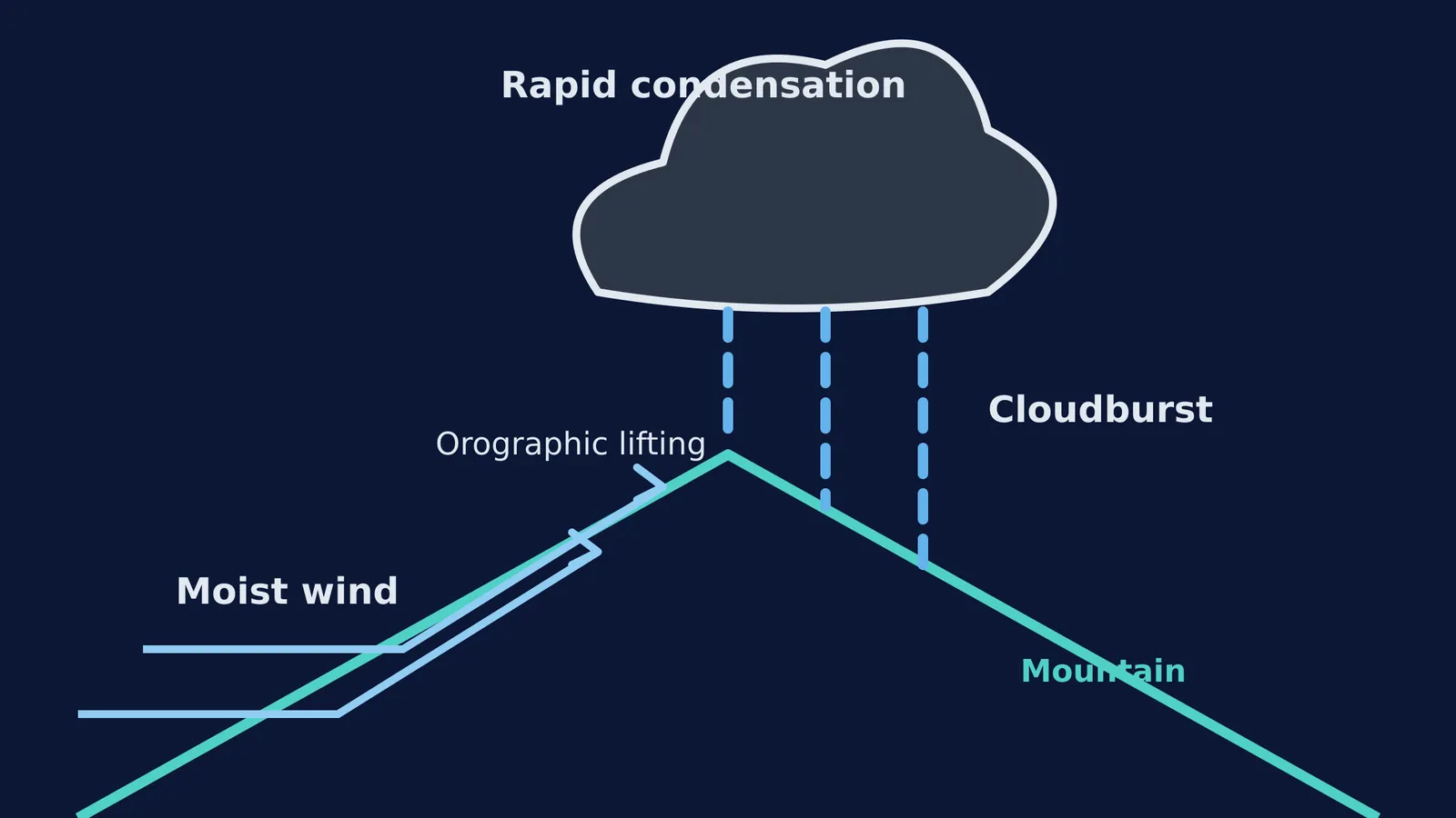
Cloudbursts are closely linked to mountainous terrain due to a phenomenon called orographic lifting. When moisture-laden winds, such as monsoon currents, encounter a steep mountain range, the air has nowhere to go but up.
Forced ascent and cooling: As the moist air is forced upward by the terrain, it experiences lower atmospheric pressure, causing it to expand and cool adiabatically. If you are studying converting PV, PT and VT graphs of ideal gas processes, you will know that rapid expansion drops the temperature of a gas without heat being exchanged with the surroundings.
Rapid condensation: Once the rising air cools to its dew point, the water vapour condenses rapidly into liquid droplets. This condensation releases latent heat into the surrounding air, making it warmer and more buoyant than the environment, which accelerates the upward movement.
Strong updrafts: The latent heat fuels powerful vertical air currents called updrafts. These updrafts are strong enough to keep huge volumes of large raindrops and hail suspended high inside towering cumulonimbus clouds, preventing them from falling as normal rain.
The burst: Eventually, the sheer weight of the suspended water becomes too great, or the updraft suddenly weakens. The balance between upward drag and downward gravity is broken, and the entire mass of water drops to the earth almost simultaneously.
Worked example: Calculating the cooling of lifted air
A key driver of a cloudburst is how fast the air cools as it is pushed up a mountain. Before condensation begins, air cools at the dry adiabatic lapse rate (DALR), which is approximately 9.8°C per 1,000 metres of elevation.
Imagine a parcel of warm, moist monsoon air at 30°C at the base of a Himalayan foothill. It is forced up a 2,500-metre slope:
Find the altitude change: The air is lifted by 2.5 km.
Calculate the temperature drop: Multiply the altitude by the DALR (2.5 km × 9.8°C/km = 24.5°C).
Determine the new temperature: The air cools to 5.5°C (30°C − 24.5°C = 5.5°C).
If the dew point of that air parcel was 15°C, it would have reached saturation long before hitting the peak. The rapid condensation that follows releases latent heat, shifting the cooling rate and fueling the violent updrafts of a cloudburst.
Simulating the forces at play
The mechanics of a cloudburst are a real-world application of thermodynamics, buoyancy, and forces. For students preparing for exams like JEE, visualizing how adiabatic cooling and upward thrust interact can make abstract concepts much clearer. Much like the free expansion of an ideal gas, rapid changes in atmospheric states can lead to dramatic, large-scale effects.
You can experiment with changing pressures, volumes, and forces in the Fermi Simulation Lab to see how these physics principles govern both textbooks and the real world.


